From the war memorial in Belton, near the church, we turned downhill past a green with a lime tree and a seat (too early for caffeine!), the Old Smithy and Rutland Manor, to a point where a footpath sign points to the left. We went through the gateway and immediately right, crossing the field to a stile in the far right hand corner. We followed the Rutland Round along the hedge and over a footbridge, then took the path along with the hedge on our right. We crossed a bridleway and continued to follow the waymarks as the path goes downhill, crosses another bridge, then uphill to a gate in the hedge and on to the old A47.
 |
They shut the road through the woods Seventy years ago. Weather and rain have undone it again, And now you would never know There was once a road through the woods .(Kipling) |
We walked left along this, then turned right to the present A47's junction towards Wardley.
 |
| From the old road to the new |
We crossed the road and walked into Wardley village with its well-kept houses and small church.
 |
| St Botolph's church, Wardley |
 |
| Time check? |
 |
| No walk is complete without one of us going back for something! |
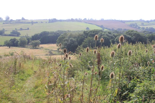
We turned down the lane past Wardley House, opposite the church. There are terrific views of the countryside.
 |
| View from Wardley House |
We walked along the track, following it round to the end of Wardley Wood. Here we turned left into the wood, but instead of walking straight though we diverted slightly to the left, in order to avoid some of the mud. We then followed the edge of the wood and headed up towards the A47 again.
 |
| Wardley Wood and beyond |
We were not really where we wanted to be, so it was a case of heading downhill and meeting the path we had left earlier. Once we'd found it, it took us up to the Old Leicester Road going into Uppingham.
We had to walk for a few hundred yards along the A47 - the north side of the road has just enough verge to make this ok. We crossed back to walk along the old disused road, then crossed over to join the footpath which follows field boundaries more or less north. There are plenty of signs telling walkers where they shouldn't go, and by avoiding them we made our way towards Ridlington.
 |
| Rolling countryside |
 |
| St Mary Magdalene and St Andrew's church, Ridlington |
We walked round to the other side of the church, and along the road for a short distance before turning right along a marked footpath. Apologies for the garmin trace here on the map - I'd turned it off in the church and forgot to switch on immediately afterwards.
We found the footpath towards Leighfield. This was straightforward, with a little help from the 'Keep Out" Notices. It goes downhill from Ridlington, passing a flock of Jacob's sheep.

The path flattens out as it approaches the River Chater and the fishponds near Leigh Lodge.
 |
| Newly planted trees and the bridge over the Chater |
 |
| Bridge and fishponds |
A good spot for a second break before tackling the long uphill road to the left.


At the top we turned left, then took the path indicated on our right. This went downhill quite steeply towards Belton. The path joins the road to Lambley Lodge, which we followed for about half a mile, downhill then up into Belton.
No comments:
Post a Comment